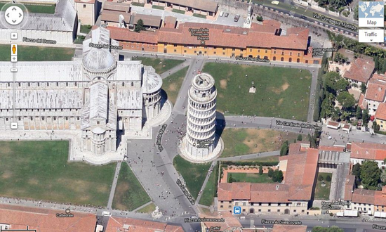
Un smart phone with gps means everything to any person. With this tool you can obtain geolocation in any part of the world, without fear of losing yourself. For that reason, we want to show you how to view your city via satellite.
through them digital applications you can have a visual of your city, thanks to its special characteristics that help you to find a location, whether when you are travelling, when you are in the region or looking for a parking lot near your work without the need for a membership.
much of them offer a 3D and 360° view that you can enjoy from the screen of your cell phone, among other electronic devices, in addition it allows you to create routes to download maps without access to a connection.
For if it was little, you can too activate the voice GPS mode if it is more practical for you to listen to traffic alerts, notifications to know which rail to take and which is the best route.
Next we present you a list with the best apps to view your city via satelliteIt is.

The 4 best map apps to see your city by satellite
1. Google Maps
In our list it must be Google, el grande de internet has an application to view maps, create routes, locate directions, know the time of the path you are crossing, among other functions.
Because it is a famous and complete application, Google Map finds any point on Earth with a structure that comprises more than 220 countries and territories assigned to navigate in real time.
Likewise, you can offer detailed information on parks, plazas, businesses, restaurants, and much more, which ones you can mark on the virtual map to observe with greater ease points of stops, time, kilometers of distance, etc.
Lo mejor de todo es que contain ratings and comments from users from your community to make exploration simpler.
2. Waze
A big competitor of Google Maps, no doubt, it's the Waze app that landed on the top of the best digital tools thanks to your multiple geolocation functions. It enjoys a wide view and detailed information about urban centers with suggested routes.
It is possible locate any strategic point in real time, always looking for the best path for the users of the Waze community who collaborate actively.
Maps with references, routes with little traffic, notifications about works on the path for accidents and setbacks are some of the most outstanding functions that you can find on the platform without having to pay a penny for it.
3. Syngic
another specialized app to create and display maps in third dimension for free TomTom is called Syngic. Tiene the possibility of detecting radars and warning in advance of variations on the road when the users of it syngic community manage.
Account with more than 200 million installations, compilation of data from more than 500 million users from all over the world to be able to have references of unique routes and tools that manage to individualize the screen of your cell phone.
In addition, it is one of the ones preferred by the travelers for being one of the first digital navigation applications without connection. However, its paid version offers additional functions, such as traffic service, voice instructions and speed control.
4. Maps.me
Finally, our last app Maps.me allows the search and navigation without internet showing optimized virtual maps with the best image quality. It manages to save time, data from your mobile and space in the internal memory.
It has multiple functions, such as itineraries and travel routes, which can be saved, updated and modified at the moment you want, in addition to the possibility to make single reservations on your mobile for the next one adventure travel.
One of the favorites for people who like to travel, but don't know where to start. Share through social networks with your friends.
Ahora que ya conoces las principales aplicaciones con las que puedes locate the map of your city by satellite for free, comment here which of them you use more in your day to day.
