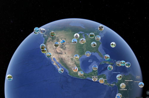
You've probably heard about Google Earth. But do you really know all its features? According to Google itself, this is a “Global cloud-based analytics platform, which allows users to view and analyze satellite images of the entire planet”.
Here, we already have an idea of what Google Earth can do, but it is used in much broader ways.
Nonprofits and scientists use it for epidemic prediction, natural resource management, remote sensing research, and much more!
In addition to being available for iOS and android, since 2017, Google Earth has gained a web version for Chrome with new tools. With this 3D maps app, you can travel without leaving home! Here are four Google Earth functions to help you explore the six continents of our planet.
1- Knowledge cards
You know the old postcards? With Google Earth you can get to know a little more of the most famous tourist spots on Earth. Just search for a well-known location or regions with these tourist spots with satellite images.

With this, you will have access to cards that present a summary of the place, in which country it is located, the history and even the number of inhabitants.
You can also click on the text if you want to know more information.
2- Voyager
Perhaps one of Google Earth's coolest features. With Voyager, you'll experience the world through expert curation. Similar to a real-time trip, it is possible to carry out “guided” tours in a country chosen according to themes, such as history, nature and culture.
To use this traveler mode, just click on the icon in the left sidebar for a helm, the steering wheel of a ship. Then, a page with the themes will open and you can select which one you want to visit and get to know. How about visiting the main museums in the world or exploring capitals like Tokyo and London?
3- Explore
This is the most basic tool in the Google Earth. You can search for any city, street or specific point to browse the region from above or use Street View – an exclusive resource for using the web platform.
To access this functionality, just click on the magnifying glass icon and type what you want to find. Once the map is loaded, you will have an overhead view of the location.
If you want to use Street View, click on the drawing of a doll in the lower right corner of the screen and then on the blue region you want to see and close by.
4- 3D Flight
Want to know more about the details of a location? 3D flight is the best option! In addition to the top view, you have an extra dimension, having access to a more realistic view of the chosen region.
If you search, for example, the Eiffel Tower, you will see the monument from different angles and you can even check the textures of the surfaces!
To use this feature, remember to leave the 3D icon turned on. In this way, all satellite images will be automatically loaded in three dimensions.
You already knew all these features of the Google Earth? Which is your favorite?
See too:
Olympics 24: France
